X

Digital Land Surveying And Mapping (DLS&M)

By Prof. J. K. Ghosh, Prof. Siddhartha Khare   |   IIT Roorkee
Learners enrolled: 816   |  Exam registration: 7
ABOUT THE COURSE :
The objective of the course is to provide basics of digital surveying and mapping of earth surface using total station, GPS and mapping software.  The course starts with introduction to land surveying followed by fundamentals of total station and its working & measurements for land surveying. Then, fundamentals, working & measurements using GPS for land surveying will be discussed. Followed by mapping fundamentals, digital surveying procedure, working, data reduction etc. Finally, the course will deals with working and demonstration of a digital land surveying and mapping of an area. This course will uncover all the major topics in pericyclic reactions and organic photochemistry.  In addition to lectures there will be tutorial sessions and assignments in this course. 

INTENDED AUDIENCE : Diploma/Degree students in Civil Engineering/Geo-spatial technology, Master/Doctoral students in Geomatics/Geo- spatial technology, Field surveyors, Professional persons dealing with Land surveying, It is an application based Course., It is a core course for Civil Engineering, Geo-spatial Technology, Geography etc and an elective course for all domains in which Land surveying may be applied.

PREREQUISITES : Basics of Physics and mathematics upto 12th standard and familiarity with use of computer

Summary
Course Status : Upcoming
Course Type : Elective
Language for course content : English
Duration : 8 weeks
Category :
  • Civil Engineering
Credit Points : 2
Level : Undergraduate
Start Date : 20 Jan 2025
End Date : 14 Mar 2025
Enrollment Ends : 27 Jan 2025
Exam Registration Ends : 14 Feb 2025
Exam Date : 22 Mar 2025 IST

Note: This exam date is subject to change based on seat availability. You can check final exam date on your hall ticket.


Page Visits


Course layout

Week 1: Fundamentals of Land Surveying & GPS
Week 2: Global Positioning System (GPS)
Week 3: Global Positioning System (GPS) 
Week 4: TOTAL STATION(TS)
Week 5: TS & DIGITAL LAND SURVEYING (DLS)
Week 6: DLS& DIGITAL MAPPING (DM)
Week 7: DM & DIGITAL DATA MANIPULATION (DDM)
Week 8: DIGITAL LAND SURVEYING AND MAPPING (DLS&M)

Instructor bio

Prof. J. K. Ghosh

IIT Roorkee
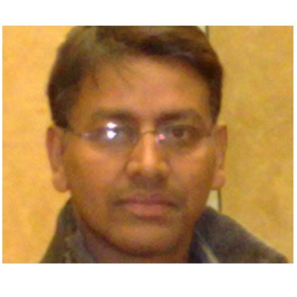
Prof.Jayanta Kumar Ghosh is working as Associate Professor in the Civil Engineering Department (Geomatics Engineering Group) of Indian Institute of Technology Roorkee. He is engaged in teaching, research and consultancy works in Geomatics engineering for more than 31 years. He is pioneer in introducing courses on GPS surveying in the UG, PG curriculum of Engineering education in India, since 1999. He has conducted many short term courses on Surveying for the building professionals as early as 2000. He has published TWO books on Surveying – Elementary Engineering Surveying and Introduction to GPS Surveying. He is member of different National and International technical associations.


Prof. Siddhartha Khare

Prof. Siddhartha Khare is currently working as an Assistant Professor in the Geomatics Engineering section of Civil Engineering department of IIT Roorkee.

He has carried out his M.Tech and Ph.D. from IIT Roorkee in 2012 and 2017 respectively. After his higher education, he worked for one and a half years as an Assistant Professor in the ESRI-sponsored GIS Department of NIIT University in India. Thereafter, he moved to Canada for his post-doctoral research work. He worked as a Postdoctoral Fellow for 4 years at the University of Quebec and McGill University in Canada. After that he worked as an Environmental Scientist at Habitat, Nature based solution company in Canada and presently associated with them as an Academic Associate. He has been invited as a Visiting Professor at the University of Québec, Canada (summer 2023), and Oklahoma State University, USA (winter 2023), collaborating with their Departments of Geography. He also served as a member of Quebec Forest Study Center and Quebec Centre for Biodiversity Science and carried out hands on training related to satellite data analysis using R programming in various Quebec universities. Dr. Khare has very rich experience in handling time-series data with Satellite, UAV and PhenoCams sensors.

Prof. Siddhartha Khare is also founder and Director of his Indian start-up company Bhoomicam Private Limited. This is an early-stage Indian start-up to develop AI and Geomatics based solutions for farmers. Dr. Khare has made significant contributions to the geospatial agritech sector. His startrup Bhoomicam has won the Best Geospatial Startup Award at the National Geospatial Awards 2024 organized by FOSSEE (GIS) IIT Bombay. Dr. Khare himself received the National Geospatial Emerging Faculty Fellow Award for his leadership in the field. His startup received Bronze Medal at the ISRS I-CON 2022 Innovation Contest in Geosmart 2022 conference.

Course certificate

The course is free to enroll and learn from. But if you want a certificate, you have to register and write the proctored exam conducted by us in person at any of the designated exam centres.
The exam is optional for a fee of Rs 1000/- (Rupees one thousand only).
Date and Time of Exams: March 22, 2025 Morning session 9am to 12 noon; Afternoon Session 2pm to 5pm.
Registration url: Announcements will be made when the registration form is open for registrations.
The online registration form has to be filled and the certification exam fee needs to be paid. More details will be made available when the exam registration form is published. If there are any changes, it will be mentioned then.
Please check the form for more details on the cities where the exams will be held, the conditions you agree to when you fill the form etc.

CRITERIA TO GET A CERTIFICATE

Average assignment score = 25% of average of best 6 assignments out of the total 8 assignments given in the course.
Exam score = 75% of the proctored certification exam score out of 100

Final score = Average assignment score + Exam score

Please note that assignments encompass all types (including quizzes, programming tasks, and essay submissions) available in the specific week.

YOU WILL BE ELIGIBLE FOR A CERTIFICATE ONLY IF AVERAGE ASSIGNMENT SCORE >=10/25 AND EXAM SCORE >= 30/75. If one of the 2 criteria is not met, you will not get the certificate even if the Final score >= 40/100.

Certificate will have your name, photograph and the score in the final exam with the breakup.It will have the logos of NPTEL and IIT Roorkee .It will be e-verifiable at nptel.ac.in/noc.

Only the e-certificate will be made available. Hard copies will not be dispatched.

Once again, thanks for your interest in our online courses and certification. Happy learning.

- NPTEL team


MHRD logo Swayam logo

DOWNLOAD APP

Goto google play store

FOLLOW US